Saturday 16th July 2011
On leaving Freshwater Bay and passing the extensive pearl lease mentioned in the last post Truansea headed towards Cape Voltaire and Montague Sound via Admiralty Gulf and Voltaire Passage. The directions advise that overfalls and strong tides may be experienced approaching the Voltaire Passage. A tidal flow of 4-5kn and overfalls to 2.5m have been observed and if wind is against tide the waves created are steep sided. Just this information alone would deter the weekend sailor but Truansea being the tough and dogged little ship she is and her adventurous skipper keep to the program and as good planning would have it wind and tide were fair and the extremes mentioned above saved themselves for another day and another adventurer to experience. Our passage was at the milder end of the scale but it was not difficult from the conditions we experienced to visualize how treacherous the passage could be if Mother Nature had not been so kind.
There were numerous islands in the Osbourne Group with many anchorages amongst them and the Mitchell River mouth can be found in the South West corner of Admiralty Gulf. For cruisers with plenty of time and fuel the Mitchell River has many scenic delights but access to many entails leaving the boat for extended periods and continuing in the dinghy. There are waterfalls and rock pools that can be used to relax and swim in safely. All this takes time and fuel and careful planning around the tides and for Truansea the big picture i.e. Circumnavigating the Australian mainland must remain the focus this time around. So it was we passed Barracuda and Krait Bays and rounded Cape Voltaire and turned southeast into Montague Sound and found a suitable anchorage close in to a fringing reef at Cape Voltaire South. Already anchored in the bay was a steel monohull and passing slowly close by we were able to exchange hellos and enough information to learn that "Outsider", a great name I thought for a cruising yacht, was owned by Ian and Wendy who hailed from Brunswick Heads.
After anchoring and sundowners we tried squid jigging but none of the ink squirting little devils would have a bar of our efforts. A calm night was spent here and Sunday 17th saw us underway before 0600 for Bigge Island and Scott Strait which separates it from the mainland. Scott Strait passage between the mainland and the island is hazardous due to a large drying reef inconveniently situated right in the middle of the passage and irregular depths. Phillip Parker King during his survey of the Region named the strait after the Reverend Thomas Hobbes Scott Archdeacon of NSW at the time. I saw nothing religious about the place save for the two passages around the reef which I suppose could be assimilated with the two passages through life, the turbulent and the calm, the decision to take one or the other based on your courage or beliefs (quite often ignorance in both cases) at any rate you end up in the same place in my view. I tend to weigh up advice provided for each direction and take the one most suited to me at the time. In this case the most recent advice provided by Ian of "Outsider" based on soundings and waypoints provided by trawler operators and personal observations with the mark one eyeball I chose the passage closer to Bigge Island. Truansea made it through comfortably against a 2knot current and I suspect the result would have been similar if the other option had been chosen. Exiting the Strait and with the flood tide still assisting Truansea anchored at Cape Pond at 1600. In the process of winding in the trolling line when coming to anchor the swivel connector between the trolling line and trace became jammed between the hull and top of the starboard rudder. Unable to free the swivel from on deck a short underwater excursion was required to free it manually. My general rule for these waters is that it is the home of big bitey monsters and I have refused their invitation to enter, however something had to be done so with Bevan instructed to stand on the cabin top as monster observer I donned the goggles and in a split second was in and out of the monsters domain with the swivel freed. I don't think they noticed. Bevan's role was purely academic I suppose at least he could have reported on the size and species that brought about my demise. That danger is ever present in the Kimberley's and not worth the risk for a purely pleasure swim. Later that evening we caught 6 fish and were busted off several times by sharks. We kept 3 of our catch for eating and 3 for bait.
Monday the 18th is a special day.
This is the day the rear admiral and my brother celebrate their respective birthdays and on this day the first of very many humpback whales 5 on this occasion joined us as we passed through York Sound past the Coronation Islands and on to Careening Bay where we anchored at 1130.
Careening Bay is significant not because it is the southern extension of Port Nelson but for the historically significant fact in 1820 Philip Parker King or members of his crew carved HMC MERMAID 1820 into a large Boab tree that was easily approached and viewed by us 191 years later. The tree is a large example of the species and in very healthy condition. The carving has expanded with the tree over time but remains clearly legible and proportional with no sign of distortion. A truly remarkable sign of the times which would be considered graffiti today and no doubt abhorrent to the green movement. But it no doubt served a dual purpose at the time to both record the visitation by King and to leave no doubt in the minds of Captains of other vessels of a foreign flag that the land was in the possession of His Brittanic Majesty. Less than 200 years later guided by charts derived from the detailed and arduous survey work of King and his crew along comes the skipper of Truansea to pay due homage to these great men and their leaders who had the foresight to finance this work for the benefit of future generations. I am humbled by their vision and efforts. With the tree and my presence duly recorded with the digital camera ( wouldn't King be astounded by this modern marvel) Truansea is soon underway again for High Bluff. We pass Mictyis Island and cross Hanover Bay to High Bluff in Port George IV. A celebratory drink for the birthdays and first whales and Careening Bay visit before a comfortable night.
Our passage on the 19th to Samson Inlet would take us through Rogers Strait and Brecknock Harbour. The former is described in the Australian Pilot as a treacherous passage. For your interest I'll quote directly from the Western Australian Cruising guide;
'There is a reef extending northeast from Umbanganan Island. Hold to the mainland (southeast) side of the strait for a safe passage. Passage north of Umbanganan Island, through Quinlan Channel is narrow. Two white floats, north of the island, usually mark the edge of the reef at the narrowest part of the channel. Pass to the north of these markers.
Passing east and south of Umbanganan Island keep about five cables off the mainland and pass about five cables to the north of Green Island. Passage may be made in a westerly direction from Green Island to north of Slade Island, where a gap in the radar beacons marking a pearl lease in the southern part of the Harbour opens up. Caution: there is a drying reef (15d27.8'S 124d36.75'E)northeast of Green Island which is exposed two hours before and after LW. Tides: The tide floods south and west meeting around the west side of Umbanganan Island (named Brecknock Island on earlier charts). It ebbs northeast and is strong during spring tides. Suggest going north through Rogers Strait at slack HW, taking advantage of the ebb through Port George IV. Conversely, go south before slack HW to take advantage of the flood. West of Umbanganan Island the tide is similar to Degerando Island. Range 10m. Caution: Pearl leases with thousands of bouys throughout the area. A radar marked channel on the southern side of Augustus Island allows through-passage avoiding the pearl leases.'
No worries got all that, yeah right! Then there is the visual and if you put it all together right you make it through. Luckily enough Truansea did and with some current assistance. Our speed through the water was 4.2 knots and our speed over the ground was 8.8 knots i.e 4.6 knots of current bowling us along, no place to get the navigation wrong skipper. This was one of many like experiences and one or two more exhilarating to come. Just a reminder that you are totally on your own in this region, HELP is not in the Kimberley dictionary be very clear about that. Then go because on the plus side many say the scenery is amongst the most impressive in the Kimberley with sheer rock faces, white beaches, boabs, bays and inlets.
With the trial of Rogers Strait astern Truansea transited Brecknock Harbour passing Kuri Bay at it's western end. Kuri Bay is a well known and extensive pearl farm base camp. From our perspective it looked like an exclusive resort with many buildings surrounded by dense bush and steep rugged hills and the brief conversation I had with whomever answered my radio call left me in no doubt that visitors were not encouraged. A narrow pass between the mainland and Kannamatju Island with a significant and photographic Needle Rock piercing through the depths saw our escape from this treacherous and unwelcoming part of the Kimberley. Several miles further on we were ushered into Sampson Inlet by a large (are they all this big?) humpback whale.
Near the navigable end of Sampson Inlet we took advantage of an unoccupied mooring put there by the Kuri Bay company I suspect as a cyclone mooring for one of their vessels and took to the dinghy for a further 3 miles upstream. At a point where the inlet narrowed and the water disappeared into a a sand sink we tied up to a branch extending from a fallen tree over the water and stepped cautiously ashore. Whilst tying up the dinghy I felt a sharp sting to my right wrist and quickly looking around to see if a snake had struck I noticed a single paper wasp cell fixed beneath the branch and as the pain was not severe I admonished the hot arsed little devil and destroyed his handiwork so as not to experience a repeat on our return. With senses heightened by that little experience we trekked on up the sandy creek bed for some distance and investigated a waterfall that could be heard above the deafening silence that all pervades an area of the Australian bush when an intruder is noticed and the fauna become invisible until they are comfortable and then surprisingly inquisitive and accepting of the
intrusion. This small waterfall provided a haven for ferns, mosses and shrubs as well as butterflies and several other winged insects and small lizards. Suspecting there might be another waterfall further upstream we ventured warily on as this looked like ideal crocodile nesting territory. We were rewarded for the extra distance by a three tiered waterfall and large deep pool at its base. The water was fresh, soft and sweet and quite cool. We spent a short while here but mindful of the falling tide and not wanting to return to a stranded dinghy we didn't tarry long and returned briskly over the sandy creek bed strewn with many large trees from a recent flood event. Back on Truansea we motored back down the inlet to a short side inlet maybe only half a mile long and anchored between the towering cliff sides. Here the tidal range of about 10m was clearly evident by the black stain on the adjacent rocky cliffs so I allowed plenty of scope in the anchor chain. This anchorage was quite remarkable because being out of the main inlet a function of it's short length was that the tidal movement was vertical and no sense of tidal movement was felt aboard Truansea despite the rise in water level of 9m. It was also here that the second crocodile of the Kimberley was to be seen from Truanse. Two red eyes steadily staring and relaying food possibility data to the thumb sized brain of that four legged swimming serpent could be seen in the torch light less
than 100m from Truansea's stern. Data rejected we thankfully saw no more of it. That was Sampsons inlet from where we departed the following morning.
Next post Truansea sails over to Raft Point where many whales were seen and a strong tidal flow took control momentarily, from there another unique wonder of the Kimberley region, Montgomery Reef and her extensive tidal waterfalls were experienced before anchoring within a days sail of the famous Horizontal Falls.
Fair winds
Brian of "Truansea"
Sunday, November 6, 2011
Friday, November 4, 2011
King George River to Freshwater Bay
13th July 2011
This morning at 0600 Truansea followed her track out of the King George River and through Koolama Bay to Cape Londonderry Western Australia's most northerly point but not as far north as Cape York. Seas were calm and wind light and variable so we started off motor sailing at 5 knots. Recognizing that these were ideal conditions to troll for mackeral in went the lure and within 10 minutes a good sized spotty mackerel had found the temptation to much to resist and gave himself up to a higher cause. Two lovely meals one of fillets the other steaks followed as a result of that fish's sacrifice.
The wind increased to 15-18 knots as we rounded the cape and Stewart Island shoals and then in the lee of the shoals as the sea flattened considerably we reached at 8 knots around Cape Talbot anchoring in close to offlying rocks. A very comfortable anchorage in SE weather.
At 0600 on the 14th we were again underway and motoring in mirror calm waters across Napier Broome Bay towards West Bay passing the Governor Islands to port. It is possible to buy fuel at Truscott landing which is a privately run airstrip servicing the oil rigs and providing a strategic convenience for coastwach and SAR aircraft. We anchored a few hundred meters out from the ramp used by the landing barge that brings in supplies and fuel for the camp managed by Shore Air. after lunch we went ashore in the tender and were fortunate enough to meet Murph who is Shore Air's manager showing a new starter, Brad around the area. I say fortunate because had we not met them we may not have been able to top up our fuel supply. Shore Air require that you make prior arrangements with them to obtain fuel and we were not aware of this however Murph being the gentleman that he is made arrangements for us to be picked up at the ramp at 0900 the following morning with our Jerry cans from where I was taken to the airstrip. Now Murph as I said is a gentleman in addition to allowing us to purchase the fuel at $2.85/litre he made sure I was provided with a couple of loaves of bread and some fresh muffins before taking me back to the tender. The airstrip is about 10km from the ramp another small detail I wasn't aware of. Murph also did me a favor and sent a happy birthday email to the rear admiral. This is a remote place and to meet someone with the means and willingness to accommodate what are simple requests in more populated areas is a real pleasure. Thank you Murph. We spent the afternoon changing the crankcase oil in the outboards and fishing and although we didn't catch any edible fish we did have some sport with a few sharks one quite large. As the day wore on some aborigines came down to the waters edge and we observed two using traditional hand spearing methods to catch fish and at least one mud crab lurking within range. We thought they were quite brave walking knee deep in water in the location Murph had advised us that a large and aggressive croc had been seen recently.
Friday morning we were underway by 0630 having waited for the ebb to begin motor sailing in calm conditions towards Geranium Harbour were we would alter course west to cross the mouth of Vansitart Bay and enter Freshwater Bay. Arriving at the head of Freshwater Bay we anchored and immediately noticed a large shark circling below Truansea. This shark kept up this vigil until at least 2300hrs when I lost interest in his antics. Freshwater Bay and the approach from Geranium Harbour through a narrow passage between Long Island and Mary Island is where west bound sailors get there first real appreciation for the tides and currents in the Kimberley's. This narrow pass also has a submerged rock and the guide advises of a chart error in it's location so it pays to be very vigilant and observant else this might be the end of the Kimberley's adventure and possibly worse. The warnings and cautions are very real.
And so a pleasant night was spent at anchor before departing the next morning for the passage through Admiralty Gulf for Cape Voltaire at the head of Montague Sound. As we passed by a large unnamed bay around the north side of the headland skirting Freshwater Bay were surprised to see an extensive pearl farming operation underway. I counted 14 work boats, 2 ships with pearl raft lifting cranes and two large cruise style workers accommodation ships. Must be a lot of money in the pearl oysters gem farming business. That lustrous little sphere has created a huge industry.
Next post we move further into the vastness of the gulfs and sounds that combine to make this such a demanding yet alluring region to visit.
Fair winds
Brian of Truansea.
Monday, October 31, 2011
King George River
11th July 2011
Forty-five nautical miles further into the Kimberley region today and anchored in Koolama Bay at 1730. Not wanting to risk entering the King George river on a low tide we anchored near the head of the bay some 5 miles from the mouth of the river. The anchorage on the north eastern side of the head of the bay is close in and very secure. 'ONDE' a large privately owned and crewed power catamaran was already at anchor. Having another vessel nearby always makes it a much simpler affair to locate a good anchorage.
Not long after sunrise we were on our way to enter the King George river over the sand bar which according to the a commercial cruise yacht from Wyndam is silting up creating some variation year to year to the entrance channel. Using the sounder we had no trouble finding the channel and making a safe entry. A remarkable feature of the Berkeley River and the King George River is that they have barred entrances similar to east coast rivers but within a few miles of the entrance 150m high vertical walled canyons replace the flatter mangrove lined banks of the lower reaches. Ever so gently we motored along in mirror calm conditions the full length of the navigable portion of the river some 6nm to where the river forks and terminates at a waterfall plunging over the 100m high cliffs at the end of each fork leg. The water at the falls is some 60m deep and it was possible to put Truansea's bow right under the falling water giving the sharp end a taste of liquid Kimberley. What an experience the bows were centimeters away from the cliff behind the waterfall and the pressure was holding her off. I asked Bevan to collect a bucket full of water for a rinse off but the water hitting him on the head and the bottom of the bucket was more than he could take so only a small amount of water was collected.
After having our fill of that experience we moved a few hundred meters downstream and anchored in about 7m water over sand. From here we took the tender ashore and after hauling it a few meters clear of the water we climbed up through about 100m of scree and then scrambled up a further 100m over rocks to the top of the cliff and made our way to the top of the falls. The direction to the falls is marked by rock cairns thoughtfully placed by others and maintained or added to by almost everyone else who passes by. The vista from the top of the falls is exactly as you see in the tourist brochures and every bit as grand and expansive as is imagined. Seeing Truansea lying so calmly to anchor some 150m below provided me with a reflective moment thankful that I had the opportunity to experience this wild, idyllic and remote gift of nature. The lure to take that special photo close to the edge of the cliffs was to much for me to resist so crawling ever closer to the precipice and laying on my stomach so as to not overbalance I snapped of some beautiful shots. We walked all around the immediate area above the falls and had a wash/swim in one of the many rock pools that abound here. The water is clear and cool and as I was later to discover quite good at colour changing my white shirt to match the iron oxide stains on the surrounding rocks. After a lazy couple of hours above the river on the warm rocks we descended to where the tender lay and headed back to Truansea and began a photographic trip downstream to an anchorage a couple of miles inside the river mouth. Along the way I trolled a lure which several fish (queenfish? barra?)took an interest in but failed to get any into the boat. About three miles from the mouth of the river it widens appreciably and a section branches off to the east. Here we came across ONDE again and this time some passengers who arrived aboard a floatplane were being received. We were then overtaken by the floatplane as he taxied downstream and downwind before turning a couple of hundred meters in front of us and roaring back past us as he took off and climbed out of the gorge. All ho hum really stuff like this happens every day! (see later Horizontal Falls post)
That was the King George River. The scenery warrants the effort to go there and climb to the top of the falls. The Berkeley and King George are as alike as they are dissimilar and indicative of the rock formations and ruggedness to be experienced right across the Kimberley region. Navigational challenges, current and tide hazards are at the lower end of those to be experienced in the Kimberleys and I suspect a visit here and return to Darwin would satisfy many adventurers and whet the appetite for the more daring and hard core. It is after here that the real foray into the wild unknown began for me.
The next post follows Truansea as she exits the Joseph Boneparte Gulf and rounds Cape Londenderry, West Australia's most northerly point, and traverses Napier Broome Bay via Truscott Landing to Freshwater Bay and an encounter with a large shark.
Fair winds
Brian of Truansea
Sunday, October 30, 2011
Darwin to Broome - The Kimberleys
6th July 2011
A fine winters day in Darwin as is most often the case saw Truansea exit the lock at Bayview Marina this time with a passenger aboard for the adventure ahead across, in, out and around the wonders and dangers of the remote Kimberley region. Began a long term friend and sailing buddy from our days sailing and racing trimarans had expressed a wish to join me on this leg of the trip around Australia if the opportunity arose. Flying into Darwin the night before and having undergone his Truansea safety and responsibilities induction he quickly warmed to life aboard as we motorsailed our way through Darwin Harbour towards our intended first stop at Port Keats on the eastern shores of Joseph Boneparte Gulf.
Sadly it was Darwin where I said goodbye to the wonderful Murray and Bev Bastion of Shirazz. Shirraz was participating in the Indonesia Rally due to dart Darwin on the 23rd July and Murray and Bev were getting her ready for the rally and further cruising to Malaysia. Without their company and knowledge during the passage from Cooktown to Darwin I would not have had as enjoyable an experience for that section of the circumnavigation. I hope that I am able to offer other cruising sailors the friendship and advice that Murray and Bev so freely and generously extended to me.
CAUTION: The Kimberley is described as a region of great beauty, ruggedness and wilderness not yet fully explored. The region covers some 423,000 sq km. The remoteness of the place can be intimidating despite it's enormous appeal. Sailors are especially advised to ensure they are self reliant, plan and equip well and above all have the ability to calculate the state of the tide at any given location at any time of the day. The region has a tidal range of up to 12m and currents to 10 knots are known to occur. Those are serious elements to be faced and dealt with and getting it wrong could have life threatening results. In addition to that there are other dangers in the form of large teeth. These teeth are found in the opening parts at the front end of waterborne beasts such as sharks and crocodiles. These animals are not very selective when it comes to their eating habits and they have the longest bloodlines of successful hunters, read-killers, of the creatures that adorn Australia's coastline. Stay out of the water they have exclusive rights!
Our passage west of Darwin started beautifully under main and jib on a flat sea with the wind aft of the beam and a steady 7 knots until almost midnight when the wind died out almost completely. Mr and Mrs Yamaha took it in turns 3 hours about to propel us towards our revised destination of Reverley Island. The island is nicely placed just outside the Berkeley River entrance on the Western shore of Joseph Boneparte Gulf. At 1700 we crossed from the Northern Territory into Western Australia and wound our timepieces back 90 minutes. The Joseph Boneparte Gulf is known amongst cruising sailors as the blown apart gulf due to the prevailing strong easterly wind and is also subject t to strong currents. We were to experience some of the strong easterlies as we approached within a hundred miles of Reverley Island. Closing on the island at around 0800 on Friday the 8th in 25+ knot winds it was imperative that we positively identify the entrance to the Berkeley River as the channel is unmarked, narrow and winding. Not so easy to do after a night without sleep and rapidly approaching a lee shore in boisterous seas and water becoming increasingly dirtier with the sediment deposits of the Berkeley. Satisfied it was the top of the tide and I was in the entrance to the channel and trusting to the advi e provided in the Western Australian Cruising guide Truansea made a safe entry over the shallow bar and came to anchor about 1.5 miles into the river at 1030. Four monohulls and three catamarans were already anchored in this calm downstream reach of the river.
At 0630 then following morning we motored upstream through the spectacular canyon style gorge that has been created over millennium by the annual outpouring of monsoonal rains draining off the Kimberley plateau. Evidence of cascades and waterfalls now dry showed as black stains broad brushed down the faces of the vertical canyon walls. A running watrfall remained at Red Falls Amphitheatre close to the navigable head of the river. Here we turned in a space not much wider than Truansea's length and returned downstream at a leisurely pace marveling at the natural beauty and enormity of the rivers work. On our way back to the anchorage we diverted into Casuarina Creek where a 20m high waterfall greeted us with a cool spray from the millions of litres of freshwater tumbling over the lip to the surface of the pool at the head of the creek. A short way back from this waterfall there was a small inlet where another smaller waterfall cascaded over the rocks. The trip up the river and diversion to Casuarina Falls took up the whole day. This first foray into the Kimberley's was both calming due to the placid water and silence of the river and at the same time mildly tense as to the newbie the unexpected is always expected and the senses remain on alert.
Sunday the 10th July and the southeaster is too strong to exit the Berkeley so we remain at anchor and take advantage of the opportunity to rest and meet a father and son taking a sabbatical and sailing their Crowther designed Eureka catamaran Zig Zag around the eastern Kimberley's broadening their fishing experiences. We saw our first crocodile of the Kimberley's, a 3m salty sunning himself on the sand on the opposite bank of the river from us. I was comfortable with the separation distance. Zig Zag advised of a different channel out of the river Thayer had observed at low tide and we decided to give it a go along with them the following morning. This route would reduce the passage to Koolama Bay by about 5 nautical miles.
Next post we arrive at Koolama Bay and explore the King George River.
Fair winds
Brian of Truansea
Thursday, September 15, 2011
Kakadu and Litchfield national park
21June 2011. Lyn, Emma and Jake arrived in Darwin by plane and picked up a hire car from the airport and made their way to Truansea without difficulty. They were surprised to see that I had lost more weight than they expected. After they had everything aboard and we had catch up we determined to start off for Kakadu the next morning.
Emma drove us out of Darwin along the Arnhem highway towards Cahills Crossing on the South Alligator River. I was still fairly tired and dozed quite a bit of the way but we still stopped at the tourist places along the way including the ones I remembered from my previous trip. The scenery is interesting and varied from flat plains to hilly country closer to Cahills Crossing and there were some spectacular rock formations. At Cahills Crossing we walked down to the viewing area above the crossing where there were a few others some fishing for barra some successful others not. Not long after our arrival there we saw a large, very large crocodile every bit of 5m long attempt to cross the causeway against the tide but after a couple of attempts he chose to return to the deep hole on the upstream side of the causeway. We were very pleased to be up on the viewing platform out of his reach as he soon disappeared below the surface.
We drove into Jabiru and booked into the Crocodile Hotel. A large and expensive but nice hotel constructed in the shape of a crocodile. We went to the Sportsmanship Club for dinner and had the best meal in the Northern Territory. My steak was possibly the best I have ever had, very tasty, tender and enjoyable. I had eaten here on my previous trip and remembered it was good then. We were all impressed with the meal and service and I would advise anyone traveling in Kakadu to have a meal there.
Next morning after a comfortable and cozy night we headed off towards Katherine. Along the way we stopped at Yellow Waters and took the walk out through the wetlands. We stopped at Mary Waters roadhouse as I had talked up the meal I had there last trip. Unfortunately the establishment had changed since then and take away snack type food was all that was available. However we went on to Pine Creek and to our delight discovered a 1960's retro style cafe that put together large homestyle cooked meals that were excellent along with the coffee and old style milk shakes. A jem of a place not to be missed and we made sure we didn't on our way back from Mataranka.
Leaving Pine Creek we drove down to Katherine and booked in to a new highset cabin at the Shady Rest caravan park. The cabin had a great design 2 bedroom lounge, kitchen, full bathroom & toilet with room for 2 cars and massive storage space underneath. Would make an ideal beach house.
Emma with her mastery of the iPhone had made all the arrangements for accommodation and our breakfast tour of Katherine Gorge. Although it was cool we really enjoyed the tour and the guide was particularly informative. After the tour we headed off to Mataranka to the famous hot springs. We were somewhat disappointed with the hot springs it seems that a recent major flood had caused quite a bit of damage and it was far from it's best and looked in general to be in need of a good dose of TLC. So back in the xTrail and return to that great cafe in Pine Creek for another meal, just as good as the last one. After that we headed for Batchelor and Litchfield National Park.
We stayed the night in a couple of safari tent style cabins at Lattitude 13.08 and had dinner at the "restaurant?" Hmm skip that next time. The tent/cabin was warm and comfortable but the showers were cold. We headed to the waterfalls for a look and a dip in the cool clear streams, very refreshing! These waterfalls are very scenic and a popular getaway for Darwinites to get a break from the incessant heat and oppressing humidity of their summer. Stopping in Batchelor at the hotel for lunch on our way back to Truansea was a good idea and we all had a good meal.
Arriving back on board Truansea after our week of touring we went to the Mindil Beach markets on the Friday night. What a market it is. Seemingly endless food stalls with the most tantalizing aromas and tastes had us sampling as much as we could eat and it was as good as it looked and smelt. Massive buffalo ribs tested us, a little chewy but you just want to keep eating. Seafood selections of all the delights of the sea and Asian style dishes that we shared so as to get taste of it all and then even a desert called a Shazam and that was just as refreshing as the name suggests. Many different types of music from rock to earthy corroborree to classical instrumental filled the entire market from end to end as each performer or group entertained the large crowds gathered around them. When Lyn and Emma had made the purchases they wanted we drove back to the marina.
We decided to go sailing for a few days and headed out of Darwin Harbour north west for Bare Sand Island where Emma, Danny and Jake had been half a dozen years before on board Honeymoon with Danny's parents at the start of there world Circumnavigation. Unfortunately we could not go ashore at Bare Sand Island as it was being used as a military training area. We were however able to fish along the reef protecting the island and landed a very nice fingermark after only a short while. This was to be the only fish we caught here but enough for meal for the 4 of us. The water was very clear and as calm as the bath Truansea's wake at 5 knots motoring was barely discernible a tribute to the hull design and balance. Moving along like this was visually surreal the mercury like surface barely disturbed and the golden reflection of the sun forming a peripheral border around us here and there a disturbance of the surface caused by a turtle's head or a brightly banded sea snake or a fleeing fish or creature unknown, just another of those unique experiences that paint the life of cruising.
We left this portrait of peace behind and moved over to Turnbull bay to anchor for the night. Here Jake got quite a fright when a large fish took the lure he was presenting from the bow of Truansea almost bending the fishing rod double. Unfortunately the reel was only spooled with light line and the fish won. I put the crab pots in close to some mangroves near the mouth of a small creek emptying into the bay just before dark and on checking them early the next morning only 2 undersized blue swimmers had made their way into the pots so I released them and returned to Truansea without delay as it looked to me like crocodile territory.
Motorsailing back to Darwin in smooth water pleased the Rear Admiral especially as shipping was limited to a cruise ship, a pilot boat and a large private and luxurious looking cruiser. We virtually had the whole Harbour to ourselves on such a beautiful day. Safely back in the marina we set about washing etc and planning a couple of trips in and around Darwin city.
The time for Lyn, Emma and Jake to return to Noosa came around pretty quickly and it wasn't long before they were heading to the airport for their trip home. This meant for me that the next stage of the circumnavigation would begin the following day. I was to be joined on this stage from Darwin to Broome via the Kimberley's by an older sailing mate who had expressed a desire to see this part of WA. Bevan flew in that afternoon and we sailed out of Darwin for the Kimberley's the next morning.
The next post will cover from Darwin to Broome and all the rugged beauty of the Kimberley's. I have deliberately not been too descriptive regarding the places and scenery experienced in the Northern Territory for two reasons, those being that it is so spectacular and varied my writing skills would not do it justice and to pay respect to the colloquialism that 'if you never never go you'll never never know'. My recommendation is do it and do it soon you will not be disappointed.
Fair winds
Brian of Truansea
Thursday, August 25, 2011
Cape York to Darwin
Friday 9th June 2011
Truansea has been lying to her anchor in the basin at Seisia since Wednesday while the skipper went ashore and replenished some stores at the supermarket and topped up the fuel reserves in preparation for the 370 nautical mile passage across the Gulf of Carpentaria to Gove (Nulhunby). Shirazz has been doing the same and I joined her crew on a ferry trip to Thursday Island yesterday. The trip on the fast catamaran ferry was very comfortable and the skipper provided commentary on the various islands and history of the Torres Strait. Ashore on TI a long stroll took me past the waterfront and main shopping precinct to the Grand Hotel where I had a very good barramundi and salad lunch with a nice cold beer. After returning to Seisia and Truansea everything was rechecked and Stretch a friend of Murray and Bev of Shirazz came aboard to provide company and an extra hand to ease the passage across the gulf. This was very welcome as unknown to me Murphy had been planning a rendezvous with Truansea the next night.
10th June and Truansea in company with Shirazz is underway at 0415 from Seisia for Gove. We passed safely through the shallows of the Endeavour Strait on the rhumb line for Gove without incident and settled down to a 20knot south easterly in fine conditions. By 2000hrs the wind had increased to 30knots backing to the south south west. I’d shortened the mainsail to the second reef as the sun went down and now decided to put in the third reef. It was a clear moonlit night a two metre swell on the beam and the wind gradually increasing and gusting above 35knots (gale force).With the third reef in the main and the jib partly furled Truansea cruised along comfortably at 6 knots on the autohelm. Suddenly very suddenly at 2100 the very end section of the mainsheet traveller directly beneath the fixed traveller blocks broke away from the aft beam. This allowed the fixed traveler block fitting to fly off and immediately after that the mainsheet car slid off the end of the traveler track and the unfettered mainsheet whipped across the stern as the boom collapsed to the saloon roof. Stretch is a pretty big bloke so I had him sit facing aft on the helmsmans seat holding the mainsheet to prevent it swinging wildly and taking one of our heads off whilst I retensioned the preventer to control the boom and furled the jib and dropped the mainsail into the lazyjacks and secured it to the boom. So with further calamity averted and Truansea laying ahull I determined to partially unfurl the jib start one motor and continue on course for Gove until daylight when I would assess the situation and check for any other damage.
Maximum wind of 38.6knots for the passage was recorded at 0100 on the 11th and remained in the low to mid thirty knot region for 36 hours with the beam sea and swell combining to a consistent height of five meters. This was not uncomfortable as I had altered course to put the swell 60 degrees off the bow and Truansea climbed over each swell and ran down the back lifting her bows for the next one in turn. It was a little wet however there being quite a bit of spray generated as the passing wavetops tumbled into white water which not being uniformly aligned slapped into the side and stern sections of Truansea with the occasional bit of green water passing over the windward bow and cabin top. In the saloon however we remained dry and relatively comfortable. A few hours of sleep was managed by each of us in turn until daylight. By 0630 I had installed a jury rig for the mainsheet and reset the third reef and we were underway as if nothing had happened. Thanks for the visit Murphy. The jury rig consisted of a loop of 14mm double braid secured around the aft beam through the scuppers and the mainsheet lower block attached to this with a D shackle simple and effective though limiting the sheeting arrangement to a single position alah dinghy style. This arrangement served me right through to Darwin where replacement parts arrived with the rear admiral for her visit.
I make special mention and thanks here to Andrew Crawford, Brisbane Seawind agent for obtaining the relevant replacement parts at short notice and ensuring they were in the hands of the rear admiral before she departed for Darwin.
 |
| Broken end of mainsheet traveller track |
 |
| M6 stud on left is that fitted by Seawind M8 stud on right is the correct one between is the broken stud and under M8 stud is the broken end of traveller track. I redrilled and retapped both ends to take the M8 studs. |
Also for balance there are brickbats for the person at Seawind responsible for fitting the traveller end blocks. The poor workmanship displayed could just as easily have resulted in serious injury or worse and that in my opinion is a culpable act of neglect. I alert all Seawind owners to check that the fixed traveller end blocks and mainsheet track have been secured to the aft beam in accordance with the manufacturer’s instructions. In Truansea’s case the traveller end blocks were fitted using M6 studs and not the Harken supplied and recommended M8 pan head studs. The lower mainsheet block was also damaged during the incident and has yet to be replaced though I understand Seawinds service manager is looking into this for me.
In the big scheme of things the traveller failure and the autohelm drive motor failure are the two most significant events that have occurred. Interesting that both of these are manmade and preventable whereas mother nature is usually considered to be the unpredictable element and she remains to date my greatest friend.
 |
| Supply ship at Seisia wharf |
 |
| Gove Harbour |
 |
| Ship at Gove |
Arriving in Gove at 2300 on Sunday the 12th about 6 hours later than anticipated we had a comfortable night at anchor before moving to an anchorage off the Gove Yacht Club adjacent to our friends on Shirazz. Murray and Bev had arrived before sunset and had an opportunity to go ashore at the yacht club. This was to provide bad news as the club had been closed by the licensing people for being a little bit naughty in who the sold liquor to and would not be reopening before at least the 30th June. Murray resourceful as ever had managed to hire a dual cab ute which was ideal to take us all the 10km into Nulhunbuy where despite the fact it was the Queen’s birthday holiday we were able to get some fresh groceries at Woolworths and fuel also. The Arnhem Club was open so we went there for lunch and there being no Laundromat in town the manager there understood our predicament and graciously allowed us to use the staff washing machine to do a few loads of washing.
Tuesday 0700 saw Truansea and Shirazz sailing out of Gove for Wigram Island. 20knots of south easterly pushed Truansea along with the second reef in and jib out to arrive and anchor at Wigram Is by 1330 with a large sweetlip on board by 1500. Ah twas good.
 |
| Starboard side entry to the Gugari Rip northbound |
 |
| Port side entry to the Gugari Rip northbound |
 |
| Halfway through the Gugari Rip northbound |
Wonderful Wednesday arrived with the expectation of passing through the “hole in the wall” or Gugari Rip. This place is a mecca for crazy types or so it seemed to me when I read about it and I can assure you that there is no way I would have attempted to pass through there on my own but being the fortunate fellow I am I had Shirazz’s experienced skipper to show the way in. There are two elements critical to making a safe passage through this narrow and forbidding pass – GUTS and TIDE in fact on first look at the narrow savage rock bordered gap and streaming water you would add insanity which on exit quickly turns to elation and satisfaction. On approach to the southern entrance the gap is not visible until less than 500m off as you round a small headland to starboard the gap widens. The guide says it is 64m wide and 1.5 miles long and almost straight. It looked more like 80m wide to me but below the water surface it is 80 feet deep and most likely 64m wide I don’t need to know! Now there is a lot of water trying to squeeze through this narrow gap and it’s in a hurry. So much so that Truansea passed through at slack water (now there’s a misnomer) no sails up both engines at idle at 9+ knots no time much for gorking around. The water in the middle of the rip is calm unbelievably calm and either side close to the rocks for say a width of 5m is a counter current with whirlpools created by the opposing streams. An amazing experience not to be missed but only for the adventurous and as I noted earlier get the tide exactly right because it may well be a far different experience if the passage was attempted at full flow. They have special padded rooms for those that might try that. Another big thank you to Murray and Bev for sharing their knowledge so that I can put that experience in my most memorable folder. Some things you get to the end of and you just want to stand on top of the cabin and shout F..K did I just do that, yes sir it was something. Looking back at the rip from the northern side the entry is far less aggressive looking with white sandy beaches and clear calm water luring you in.
So reading the limited information available on the Caddell Strait I figured it couldn’t be any worse than the rip and opted to pass through there instead of following Shirazz around the outside. I was later to learn from them that they thought I was pretty brave to do that. Well it was to prove pretty damn adventurous as well. After a pretty hard slog for 5 hours, 30 knots at times and up to 3 knots of adverse current I eventually made it to the eastern entrance to Caddell Strait and found my way in over the bar by depth sounder and I suspect a lot of luck as there were times when I had as little as 0.7m beneath the keel. Inside the strait proper with daylight disappearing ahead and about 20 miles still to go I was very glad of the full moon because a few miles ahead there was a section called the narrows that consist of 1.5 miles of whirlpools and overfalls. Happy that I would pass through there near the top of the tide I continued on, wasn’t a lot of choice anyway. At the narrows the whirlpools first became evident when my speed over the ground reduced to 2knots from 6knots and within a 100m or 200m the SOG would increase to nearly 9knots. In the silvery glimmer of moonlight on the surface I could see extensive whirlpools and overfalls not so bad in poor light but may look as treacherous as the guide says in daylight. Either side I could make out the silhouettes of the mangroves lining the edges of the strait and was able to maintain a course near enough to the middle and with plenty of depth continued through the whirlpools for about 1.5 miles and then in calm water with the tide assisting I made the anchorage off Galiwinku on the far western end of Elcho Is at 2130 where Shirazz had arrived many hours earlier and were looking out for me. What a wonderful Wednesday.
Thursday 16 0630 and Shirazz and Truansea are underway again for Cape Stewart 50 miles closer to Darwin. It was at this anchorage where we had sundowners aboard Easy Rider a Lightwave 38 with Rob and Henma.
Friday 17th an early start 0515 for North Golbourn Island 112 miles away and after chasing every puff of wind and using the spinnaker whenever possible I gybed and gybed to keep up speed eventually arriving at Mullet Bay at 2130 SHirazz again already anchored ahead of me.
Saturday 18th and off again at 0630 to round Cape Croker and anchor in Sommerville Bay. Cape Croker is the most northerly point of the Northern Territory and only a few miles further south than Cape York. It’s a terrible place full of dirty rough water where two tidal planes meet. A long low flat headland that requires an offing of at least 5 miles to avoid the boiling melee. Sommerville Bay on the other hand when reached is calm and reasonably well protected close in. I anchored here at 1630 after 85 miles of pretty rough water. Shirazz had taken a different passage inside Croker Island and anchored some 7 miles closer to Darwin than Sommerville Bay. To make up the gap I got underway at 0330 on Sunday 9th for Alcora Bay adjacent to Cape Don. I could see Shirazz’s anchor light by 0500 as I passed their position determined to get to at least one anchorage ahead of them. And I did arriving in Alcora Bay by 1245 later invited aboard Shirazz for a BBQ which was most welcome and enjoyable.
Monday 20th June 2011
Before I left Noosa I reckoned on arriving in Darwin on the 20th June and if I manage the 95 miles today I’ll meet what was a loose target at that time. And so at 0330 Truansea is underway alongside Shirazz from Alcora Bay for Fannie Bay, Darwin. And make it we did by 1730 all anchored off the Darwin Sailing Club and a phone call through to the rear admiral to advise. The passage down from Alcora Bay was heavily influenced by tide. The flow past Cape Don reaches 6 knots and luckily it was in our favour and we had a terrific run down past the Vernon Islands. There are quite a few counter currents and back eddies closer in to Melville Island but when these are found they can be quite helpful. I found that by looking for the lines of weed I was able to pick up a favourable back eddie. These were sometimes only 20 or 30m from my current track where the tide was going in the opposite direction. Closer in to Fannie Bay I had to motor sail as the wind died out almost completely for the last 20 miles.
The anchorage at Fannie Bay is between 0.5 and 1 mile offshore so quite a dinghy ride in but a visit to the club is well worth it and should not missed by any cruising yachtie. The water in the Darwin Harbour is calm and clear and the city looks to have doubled in size since I was there some 9 years ago.
The coastline from Gove to Darwin was in general shrouded in smoke from bushfires so I can not provide much of a description as regards the scenic beauty or lack of it. I did not go ashore as all the land I passed was either aboriginal land and a permit was required or the shore unsafe to approach due to rock and shallows. There is also the well publicised danger of crocodiles. In summary it was dull and uninviting.
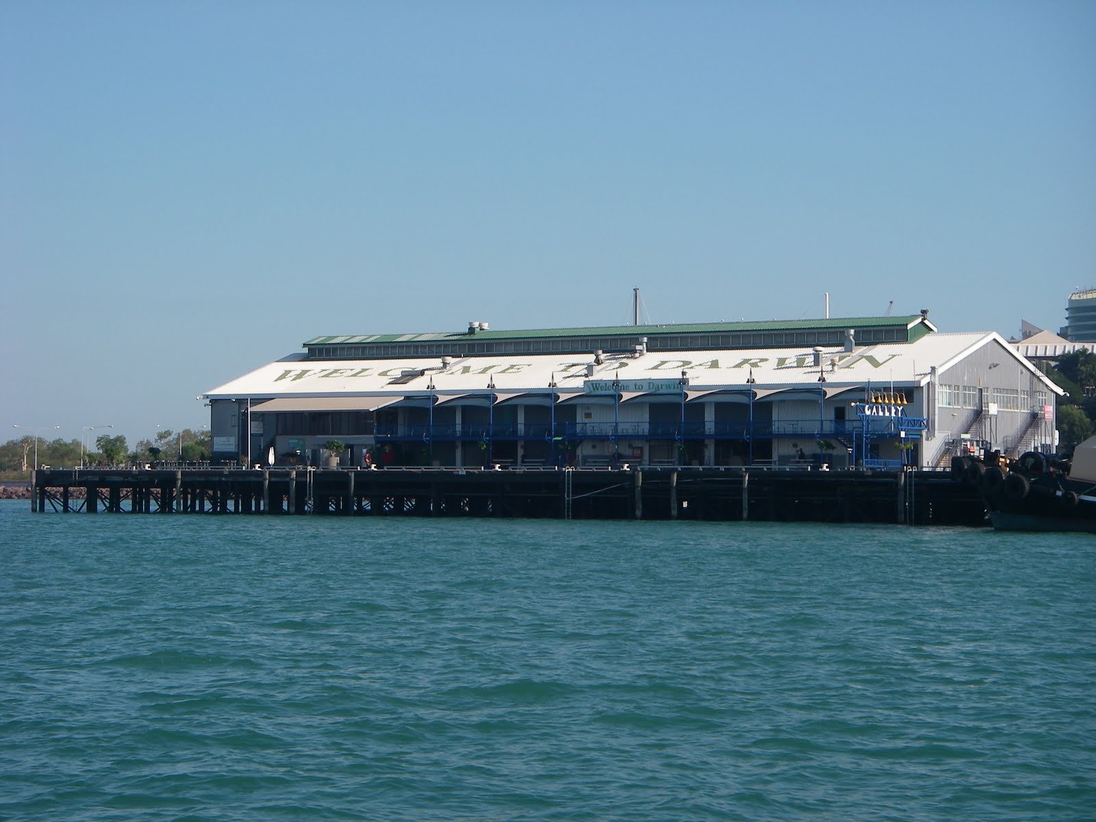 |
| Stokes Wharf Darwin |
The coastline from Gove to Darwin was in general shrouded in smoke from bushfires so I can not provide much of a description as regards the scenic beauty or lack of it. I did not go ashore as all the land I passed was either aboriginal land and a permit was required or the shore unsafe to approach due to rock and shallows. There is also the well publicised danger of crocodiles. In summary it was dull and uninviting.
Well that’s the trip to Darwin another milestone in the circumnavigation attempt. The next post will be about Darwin and Lyn, Emma and Jake visiting and the terry tourist trip around Kakadu.
Fair winds
Truansea
Sunday, August 14, 2011
Cooktown to Cape York
Thursday 2nd June 2011
As I motor through the beacons marking the exit to the Endeavour River my thoughts are on the information in Alan Lucas’ Cruising The Coral Coast and especially aware that from here my journey becomes much more self-reliant due to the absence of settlements and any ready assistance should Murphy have a win over my standard of preparation. As it turned out I avoided any confrontation with Murphy and his infamous catch you out scenarios. Cape Flattery is the Headland I set course for and then a slight deviation east to put Truansea on track for Lizard Island. Lizard Island is a Mecca for most southern sailors as it is a recognized achievement to arrive there and invariably it is the northern most point for those east coasters who return south from there when the northerlies begin. Not for the intrepid Truansea this U turn business it’s onwards and upwards to Cape Melville or so I planned. After a secure and comfortable night anchored in Mrs Watsons Bay in 2m of very clear water over sand some 200m from Shirazz I set off on a fine clear morning at 0600 under full sail. Truansea passed through a narrow stretch between the GBR and Howick Island at 1200 keeping right to the edge of the channel to allow Mighty Ocean a 190m cargo vessel room to overtake. At 1530 Truansea passed between Cape Melville with all its millions of smooth granite boulders and Pipon Islet and being so early opted to cross Bathurst Bay and anchor at the western end of Flinders Island. The anchor was set at 1815 after the longest daylight passage so far of 97 miles. Happy with that effort I celebrated both that and the fact the Island was named after the original Australian circumnavigator with a glass of wine and a T-bone steak I’d been eager to tackle.
Saturday morning and 0645 had us underway for Morris Island. By 1430 I had a nice spotty mackerel on board filleted steaked and in the fridge. This tasty fish provided me with 3 large fish dinners and very nice it was each time. A busy day in light winds passing many small islands and coral cays then safely anchored off the beach at Morris Island at 1730. Shirazz had anchored ahead of me by almost 2 hours and the crew had been ashore and advised me that there were croc the tracks on the beach. I take no more convincing that it’s not wise to take a swim.
Sunday 5th June 2011.
A very special day as it marks 40 years since rear admiral Lyn and I were married. Special in a number of ways not the least being that I am a very lucky fellow to have had such a dedicated and wonderful wife all these years who tolerates and supports my endeavors no matter how unusual or non-mainstream they may be. Without her love and support I would not have achieved the many challenging goals I have set myself over the years. She has endured some nonsensical whims of mine but remains my lifelong partner and I find it difficult to know how to thank her enough as she never has any expectation of gratitude. And so the love is there both ways an unerringly strong bond and I am a very fortunate fellow.As luck would have it I had enough phone signal passing Cape Direction to call Lyn at 1430.
Truansea anchored at Portland Roads this night and got underway for Margaret Bay inside Cape Grenville at 0630 on the Monday. The stretch from Flinders Island to Cape Grenville is known as the horror stretch referring to the lack of good anchorages along the way however my experience was all good. There is not much in the way of scenery to describe that might colour the report but sailing wise it was as good as could be expected given the reef and navigational challenges.
 |
| Cape Melville and her millions of granite boulders |
 |
| Mighty Ocean overtaking near Howick Is |
 |
| Section of the Great Barrier Reef, must be daunting in the dark. There are hundreds of miles of this so pays to keep a good lookout and keep tabs on where you are on the chart. In some parts there is much less than a mile gap. Fortunately there are many lights and beacons marking the main shipping channels. But then you have the ships to avoid. |
Discussing the next passage to Cape York with Shirazz I made plans to follow their suggestion and head through Albany Pass if I could arrive in time to get the tide right which is critical as it races up to 5 knots. That would not be pleasant if I arrived with the tide against me. If my days run was to be slow then I could divert into the only acceptable anchorage in these parts the Escape River and take on the narrow pass the following day. As luck would have it I arrived at the southern entrance to Albany Passage at 1700 with the tide well and truly in my favour as Truansea passed through in calm water at 8.2 knots under first reefed mainsail only. At the northern end of the passage is Cape York on the port beam a nondescript low rocky headland tapering down to the water’s edge. At 1800 after rounding Eborac and York Islands I anchored adjacent to Shirazz about 300m from the cape and joined them for a celebratory drink. Another long day with 98 miles logged but a wonderful sense of achievement reaching this milestone.
 |
| A bulk bauxite carrier near Albany Island punching into the swell that was helping me get to Albany Passage on time. |
 |
| CapeYork sloping down to the water from Albany Passage |
 |
| Chart Plotter snap of the anchorage at Cape York |
On Wednesday the 8th June Truansea and Shirazz motor sailed across to Seisia and anchored in the basin there for 2 days to victual, fuel up, rest and take a trip on the ferry across to Thursday Island.
The passage across the Gulf of Carpentaria to Gove was planned in detail at Seisia and I was accompanied for this passage by Stretch a friend of Bastions aboard Shirazz with the suggestion that I would get more sleep if Stretch was able to stand watch. You will read in the next installment how that was not to be as Murphy who had let me alone on the East Coast while he terrorized some other unfortunate soul paid a visit in the dark hours and wreaked havoc.
Fair winds
Truansea
Saturday, August 13, 2011
Innisfail to Cooktown
Mourilyan Harbour (Innisfail) to Cooktown – Sunday 29/5/2011 – 1/5/2011
It is now Saturday 13/8/2011 ITruansea is anchored at Canarvon WA diametrically opposite her starting point at Noosa and at last I have been able to fix the problem with the USB ports that have prevented me from using anything other than my chartplotter program which fortunately is one of my most helpful aids to navigation otherwise the laptop may have joined the collection in Davey Jones’ locker. More about that as we go along for now let’s return to the voyage.
After a restful night in Moresby Creek I raised all sail and made for Cape Grafton east of Cairns It was an overcast start to the day and shortly after leaving Truansea was overtaking a Canadian flagged sloop after exchanging waves I raised the spinnaker as the wind was light and variable. By midday the wind had settled into a proper 20 knot south easterly trade wind and the spinnaker was doused. I brought Truansea up close to Fitzroy Island for a look at the anchorage for future use. There already being several vessels at anchor there I opted to make for lee of Cape Grafton for the night. It is quite shallow about a mile offshore and reasonably well protected from south easterly winds and I had a comfortable night.
 |
| Cairns wharf precinct |
Monday morning the skipper refreshed and fed saw Truansea motor sailing across to Cairns Cruising Yacht Squadron where I had made earlier arrangements to tie up alongside for a couple of hours. CCYS is a few miles up Trinty Inlet which afforded me the opportunity to take in the multi-million dollar Quay frontage of Cairns with all it’s tourist orientated activities. It certainly is a world apart from the Cairns I visited in 1969! Between the commercial area and the CCYS the Royal Australian Navy has a substantial base. I counted 13 ships of the fleet in harbour and a further 6 large landing type craft were departing and passed close by to port. No one saluted Truansea however being a friendly navy several officers on the bridge of each ship and ratings about the decks waved so I returned a very energetic wave to each.
Tying up to the CCYS floating dock went very well despite the limited space. I had only to phone a cab and go to Whitworths chandlery for the electronic charts I’d ordered and top up my water tanks. This took all of about 90 minutes and I was on my way again down the inlet with the tide heading for the Low Islets. The skipper was somewhat relieved to be clear of the this very busy port and sailing in open water again. The Low Islets is a small cay 7.5 miles north east of Port Douglas and a popular day tourist destination for people emanating from there.I was fortunate enough to pick up a vacant mooring there in full view of the light house and the delightful surroundings.
Tuesday 31st May and Truansea had her spinnaker up before 0700 underway for Cooktown through the section of the Great Barrier Reef that trapped the Endeavour and her crew in 1770. Every modern mariner who sails the waters of the Great Barrier Reef owes a debt of great magnitude to the skill of Lieutenant Cook and his skilled and able crew for charting a safe passage through these treacherous parts of the Coral Sea. Sailing through the GBR with good weather, lighthouses, beacons, charts and modern electronic navigation aids requires constant attention to ensure the passage is safe. Solo sailing through there with the spinnaker up may seem a little arrogant to those earlier mariners like Cook, Flinders, King and lately Alan Lucas and his informative guide but it is due to their attention to detail and diligence that I was able to do this.
 |
| Non-compliant SL installation (for my old work colleagues) |
The Endeavour River was entered at 1600 and the anchor set 200m out from the boat ramp at Cooktown. Here I spent the first day of June playing Terry Tourist enjoying a morning coffee at Jacky Jacky’s walking around town , visiting the very interesting and informative museum and having lunch at the very cosy and friendly RSL club. Most importantly of all I was able to find a nice ruby anniversary card to send to the rear admiral in time for the 5th June. It would be in Darwin when I would see her again.
 |
| Good coffee here, the proprieter is Asian. |
 |
| We salute you. |
The following update will cover the remainder of the passage through the GBR from Cooktown to Cape York (Seisia).
Fair winds
Truansea
Fair winds
Truansea
Saturday, May 28, 2011
Airlie Beach to Mourilyan Harbour
 As noted in the previous post my extended stay in Airlie Beach was brought about by the failure of the Raymarine autohelm drive motor. The faulty part being replaced in a timely and professional fashion allowed me a little extra time to spend with my brother. Airlie Beach is not high on my list of places to visit being so much like other tourist orientated Mecca's e.g. the Gold and Sunshine Coasts but I was impressed with the friendliness and positive attitude of the business operators in Cannonvale and Airlie Beach that I came across. So if you yearn for touristy places this is one very friendly one. There are any number of tourist delights for you to see and enjoy here and it is one of the best naturally scenic areas in the world. Photos of the Whitsundays, far better than I can produce, abound on the web and in glossy tourist brochures.  |
| Anchorage at Cape Gloucester, Gloucester Island in the background Monty's resort just out of frame to the right. |
 |
| Cape Gloucester bottom of picture with Gloucester Island above. The passage is well marked. |
 |
| Abbot Point coal loading wharf. Not a ship in sight. |
 |
| Cape Upstart. A small section of a lovely remote place. |
 |
| Kajabbi - a modified Nichol islander trimaran. |
Since leaving Airlie Beach I'd noticed a blue trimaran in my wake and anchored nearby at night and at Cape Upstart anchorage I had an opportunity to exchange a hello with the owner as he motored close by.
Kajabbi is a pretty trimaran easy on the eye and cleverly modified. These are an older style of trimaran still popular for affordable coastal cruising. Mick and Adele are the couple on board and I was to share the anchorage with them again at Cape Bowling Green and further north at Horseshoe Bay on Magnetic Island. Here I was to learn that the couple both come from Kajabbi a small town north of Cloncurry that I was aware of as a fellow sapper from my army days some 40 years ago hailed from there also. Mick had spent a year in Mackay refurbishing and modifying the tri and had done a pretty good job of it. He and Adele are new to sailing and had been emulating my sail settings as they motor sailed along. A lovely couple who with a few more months experience on board will be really relaxed and enjoying themselves. The couple of days sail prior to Horseshoe Bay were blowy and bumpy but hadn't deterred them. Kajabbi remained in Horseshoe Bay when I sailed out at sunrise on the 25th May headed for Orpheus Island under jib and double reefed main. Interestingly the weather forecast for Cardwell to Bowen offshore waters for that day was for winds 20 to 25 knots SE but Truansea rarely experienced anything below 30 knots from the south until well passed Havannah Island and in the lee of Great Palm Island.
 |
| Sunrise Horseshoe Bay, Magnetic Island |
Having such a good run I abandoned plans to stop at Orpheus Island and instead opted to cross the passage between Orpheus Is. and Hinchinbrook Island and make for the anchorage at Lucinda. Lucinda is the site of one of the longest wharves of it's type in the world. At 5.6km long it dips almost 2m over it's length due to the curvature of the earth. There are three large bulk sugar sheds at the onshore end of the wharf and a small but very peaceful anchorage 200m off afforded Truansea a secure and comfortable night.
|
| Entrance to Lucinda past the wharf. The GPS again has sub 5m accuracy. Double click on image to enlarge |
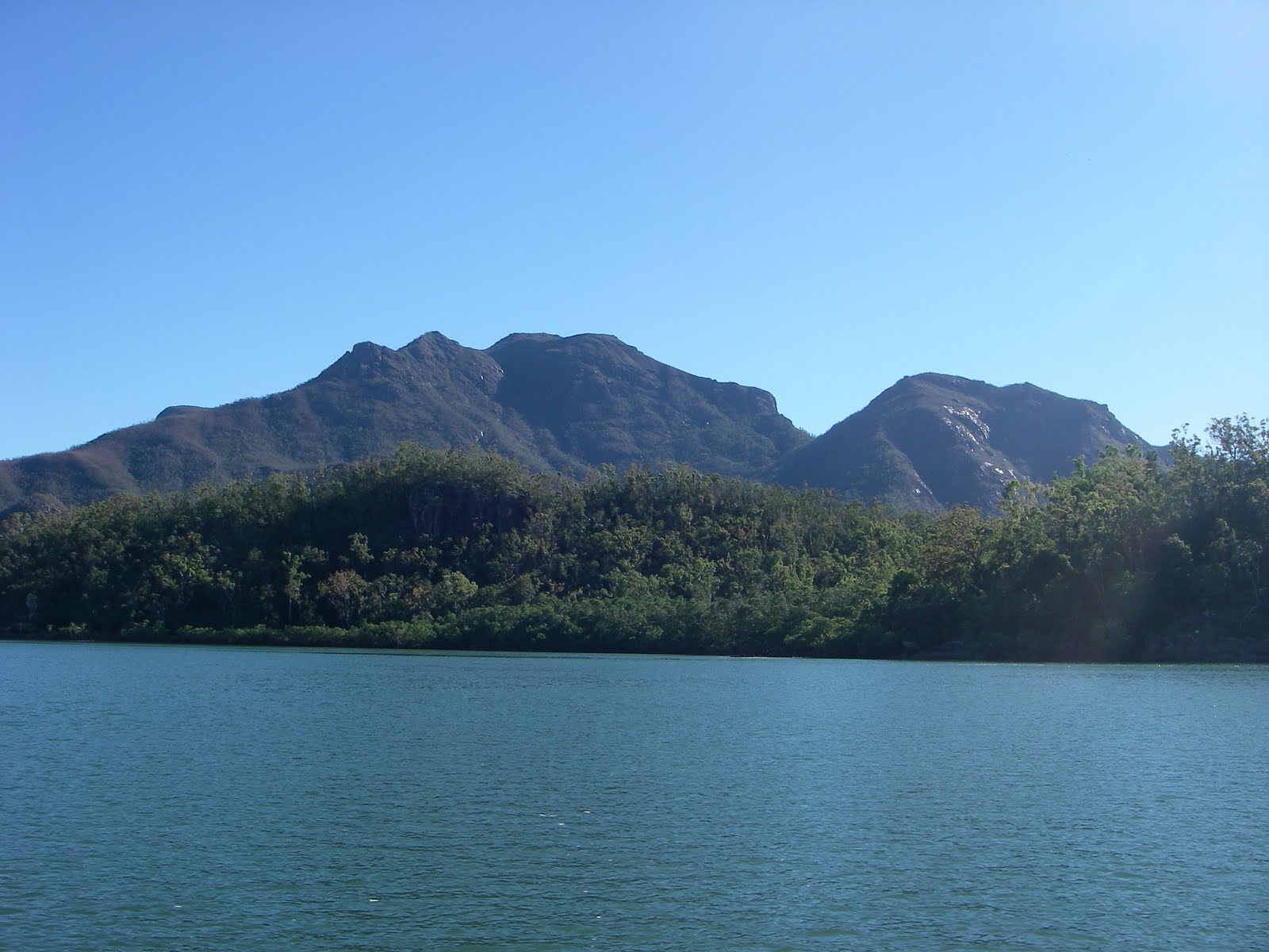 |
| 20 miles of Hinchinbrook Passage just like this near the southern end. Full sail gliding along at 5 knots. |
 |
| About 15 miles further north a spot called Angels Wings. |
That's the Hinchinbrook Passage steep rugged hills on the starboard side heading north and mangrove lined creeks to port. One of those creeks closer to the southern end is the Herbert River. Closing on the northern end of Hinchinbrook Island Truansea diverts to port from her course at Scraggy Point for her overnight anchorage about half a mile offshore from the Cardwell Jetty. Here is where I go ashore the following morning, Friday, to stock up on a few grocery items. I preferred to shop here rather than Cairns because every little bit helps these cyclone Yasi ravaged businesses to stay open and assist with community morale. I have experienced first hand the destruction tropical cyclones can wreak on communities and the natural and built environment. Cyclones Ada, Althea and Winifred and the associated 1974 flood being the most devastating. We had been lucky on those occassions not having serious personal loss and damage but I really feel for those most affected and noticed that there are still many homes and businesses in Cardwell tarped up or abandoned. The damage to trees for at least 80km and most likely 100km of the coastline that I passed is truly unbelievable. In places it reminded me of the sparce hairs on a mangy dogs back. Yasi will be remembered for generations to come in the Tully/Cardwell area and the Family Group of Islands. Dunk Island is probably the better known of this Island group and the damage there is no less than is seen on the mainland.
The sail across Rockingham Bay on Friday afternoon to Brammo Bay on the NW point of Dunk Island was your typical lazy Sunday afternoon sail. After a comfortable night at anchor Truansea set off for Mourilyan Harbour a further 20 miles to the north west arriving there at 1130. Along the way I changed the lure I had been trolling unsuccessfully for the last 200miles for a nice shiny spoon. What a good choice. within half an hour I had a strike but dropped it. Probably over anxious and excited. Never mind about half an hour later we had the real deal. A nice tuna mackeral brought aboard and despatched from this world with the pacifier. Hung by the tail over the aft beam to bleed I set about dropping sail as we had reached the entry to Mourilyan Harbour. Safely anchored inside the surgeon in me filleted flesh from bone and took a couple of happy snaps before refrigerating future meals. Being careful not to attract the crocodiles reported to be in this anchorage in the Moresby River I was very fussy about the clean up. Yes it was fresh tuna and rice for dinner and not to bad either. Tomorrow Truansea is off to Mission Bay in the lee of Cape Grafton or Fitzroy Island nearby whichever takes her fancy for the night before a short leg into Trinity inlet and Cairns on Monday. After a day stopover in Cairns to pick up some electronic charts for the NT and WA Truansea takes on the far north coast and Cape York.
The blog will continue as time and signal permit.
 |
| Tuna Mackeral |
 |
| Sashimi anyone? Sliced to your preference. The wine is for dimensional reference. |
Subscribe to:
Posts (Atom)